4 peaks, one challenge
TEXT: NANE STEINHOFF I PHOTOS: ALTA BADIA, ALEX MOLING
Adventure, adrenaline and breathtaking views: This is what awaits those who accept the ‘4 Peaks Alta Badia’ challenge.
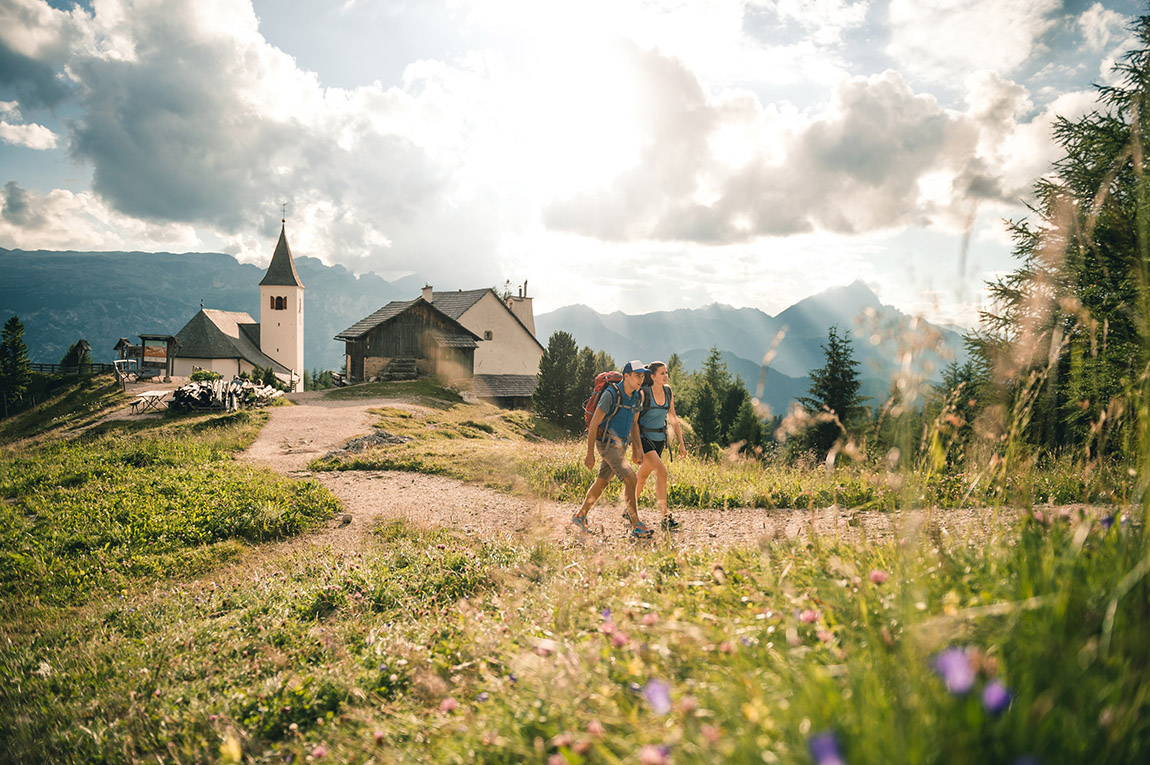
Trekking, hiking, free climbing, bike touring or paragliding are just some of the activities that can be enjoyed in the heart of the Dolomites, a UNESCO World Heritage site. In the region of Alta Badia you can safely experience precious moments of pleasure in the mountains. While winter attracts ski and snowboard enthusiasts, summer can be equally enjoyed in the region with extensive natural landscapes at the foot of majestic peaks, sustainability and hospitality, centuries-old traditions, fine dining and excellent wines.
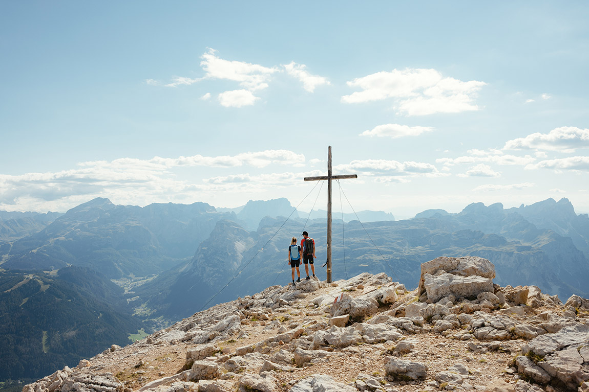
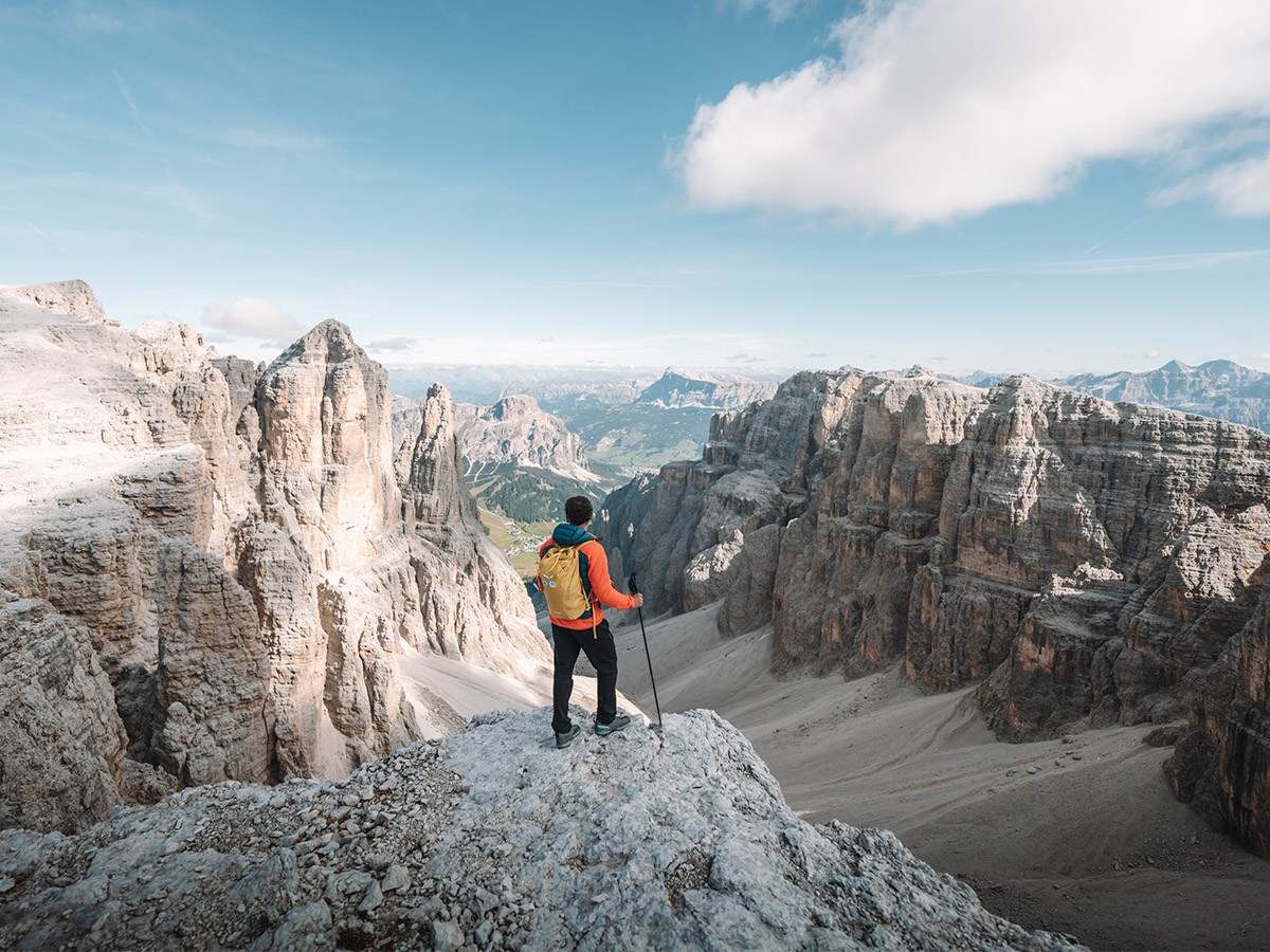
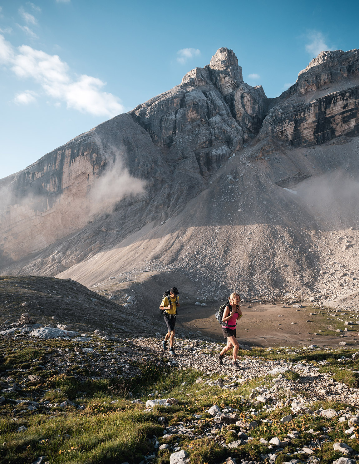
Expert mountaineers, however, flock to the region looking for new challenges during a somewhat different experience: The 4 Peaks Alta Badia challenge. The aim is to climb the four peaks Sas dla Crusc (Sasso Santa Croce) 2,907m, Sasso delle Dieci (Cima Dieci) 3,026m, Lavarella 3,055m and Conturines 3,064m on the edge of the Fanes-Sennes-Prags Nature Park in the Dolomites UNESCO World Heritage site. “For lovers of the Dolomites and more fit walkers, this is a lovely challenge and we recommend it,” read a review by Krystina Dvorak from the Czech Republic on the official website of the 4 Peaks Challenge.
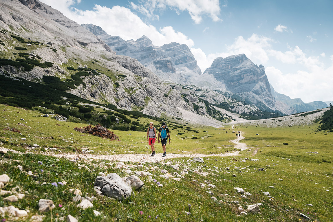
These demanding hiking tours take excursionists literally up hill and down dale. Climbers follow well-maintained trails, paths and some via ferratas up to the peaks through, while some exposed, unsecured sections of the route add an extra sense of adventure. For those who want to avoid exposures there is an alternative longer path available. The ascent of these four mountains is to be attempted only by experienced climbers, as these peaks cannot be reached just on easy well-sign-posted paths, but also via routes with some very exposed sections.
As proof of your achievement, you will get a pass which must be stamped every time you reach one of the four summits. All those who complete all four summits in two or more days bear the title ‘Alta Badia Finisher’. And those who succeed in climbing the four peaks within a single day will be named ‘Alta Badia Mountaineer’ and be granted a place of honour on the online ‘Wall of Fame’. Participants can also take home a diploma and a medal as a memento.
The route
From the village of Badia, participants take the La Crusc/Santa Croce lifts up to the La Crusc/Santa Croce sanctuary at the foot of the Sas dla Crusc mountain where path no. 7 starts, which after 2.8 km and 1:30 hours of walking leads to the Ju dla Crusc ridge on 2.612 m. They continue for 1 hour for 1.9 km on path no. 7B to reach the Sas dla Crusc.
The second peak is a short distance away: after 1.6 km and about 45 minutes of walking they reach the Piza dales Diesc (Cima Dieci mountain). The last section involves a short via ferrata. Participants return along the same path no. 7B until they are back at the Ju dla Crusc ridge. From this point on, two different route options are possible for reaching the other two peaks.
Itinerary No. 1 is shorter but more exposed and is recommended for expert climbers.
Starting at the Ju dla Crusc ridge, the route continue son path no. 7 and then no. 12 via the Forcela Medesc where the path is exposed and recommended only for more experienced rock climbers. After around 3:30 hours, they reach the summit of the Lavarela. A further major effort is required to reach the last summit via path no. 12B which after 1 hour and a last section of via ferrata leads to the summit of the Conturines mountain, the highest of the four peaks, which requires considerable technical skills, strength and character.
The adventure, however, is not yet over even after the 4 peaks have been climbed: another 3:15 hours remain to cover 9 km of route to the Fanes/Ju dal’Ega meadows, first on path no. 12B then on no. 11, which leads to the Col de Locia mountain and finally to the Capanna Alpina mountain hut, where there is a hut, ample parking and a taxi service. This route has a total duration of 11 hours, with a total distance of 25.40 km, a total climb of 1,969 metres and a cumulative descent of 2,293 metres.
Itinerary No. 2, on the other hand, is slightly longer and less exposed which is perfect for more cautious climbers. Starting at the Ju dla Crusc ridge, participants continue on path no. 7 and then no. 12 in the direction of the Fanes plateau, passing by the Lavarella and Fanes mountain huts. They then take path no. 11 which leads to the Lé de Limo lake and the Gran Fanes mountain hut until they reach the little Ju dal’Ega ridge. From here they continue 4.6 km upwards on path no. 12B for 2:30 hours until they arrive first at the summit of the Lavarela and, after a final section which involves a via ferrata, they reach the summit of the Conturines mountain.
From this point, the path returns to that of itinerary no. 1 to reach the Capanna Alpina mountain hut. This tour with the variant has a total duration of approx. 14 hours, with a total distance of 34.50 km, a total climb of 2,396 metres and a cumulative descent of 2,718 metres.
Armin Craffonara, a mountaineer from Badia who participated in the 4 Peaks Challenge in 2019, said: “The long tour is really beautiful. It’s a real spectacle for all lovers of wild nature. You do have to pay attention though; the length of the long tour is not for everyone. I’ve made a lot of trips in the Dolomites, but I think that this is really at the top of the list!”
HOW TO PARTICIPATE
Register online or at the ticket office of the La Crusc/Santa Croce chairlift, sign the information form, and collect your 4 Peaks Alta Badia kit at a cost of €35.00, which includes the 4 Peaks Card, a tour map, a briefcase, a bandana, a headband, an ecological pen and a sticker, or the 4 Peaks Alta Badia Kit + T-shirt Salewa for €55.00. Also make sure that you are ready to take on this special challenge physically; it’s not for everybody.
MORE INFORMATION
Web: www.4peaks.it/en
www.altabadia.org
KEY FIGURES – ITINERARY 1
Duration: 11 hours
Distance: 25.4 km
Height difference: 1,969 m
Starting height: 2,045 m
Maximum height: 3,064 m

Subscribe to Our Newsletter
Receive our monthly newsletter by email